Top Stories
Major Winter Storm Disrupts Midwest Travel, More Snow Incoming

URGENT UPDATE: A powerful winter storm is currently hammering the Midwest and Great Lakes region, wreaking havoc on post-Thanksgiving travel. As of this morning, heavy snowfall and treacherous road conditions have delayed flights and caused significant disruptions for millions of travelers returning home.
The storm struck on November 25, 2023, during one of the busiest travel weekends of the year. Major airports in Chicago and St. Louis are reporting average delays of approximately one hour, with meteorologists alerting travelers of an impending second winter storm that could bring more chaos to the Northeast early next week.
The National Weather Service (NWS) has issued winter storm warnings and advisories from Montana to Ohio, with certain regions receiving over 8 inches of snow by Saturday morning. In a dramatic incident, at least 45 vehicles collided on westbound Interstate 70 near Terre Haute, Indiana, leading to highway closures but, thankfully, no serious injuries reported.
Northern parts of Iowa have already seen significant snowfall, and similar totals are expected across Chicago, other areas of Illinois, Wisconsin, Indiana, and Michigan. Forecasters predict snow rates may exceed one inch per hour in some locations, creating perilous travel conditions for both air and ground transportation.
The storm’s effects extend beyond the Midwest, with the same weather system forecasted to trigger thunderstorms and heavy rain from southern Missouri down to Louisiana and Texas. Residents are advised to remain indoors as wind-driven icicles form on Chicago piers and motorists navigate slushy, snow-covered roads.
While conditions have not yet reached blizzard warning criteria—which require sustained winds of at least 35 mph, visibility under a quarter mile, and a duration exceeding three hours—local authorities are urging caution. Sheriff Del Garcia of Grant County, Indiana, advised residents to “Stay home, have a nice cup of hot chocolate, watch some TV, play some games.”
AccuWeather meteorologist Alyssa Glenny stated, “The corridor to face the most notable disruptions includes those within the six-to-12-inch snow bands, particularly in Des Moines, Chicago, Green Bay, Milwaukee, and Grand Rapids. These locations are projected to experience the heaviest snowfall, making travel extremely challenging.”
Looking ahead, another storm is on the horizon, originating from the South-Central U.S. and set to advance northeast through the Southeast and into the Northeast corridor. This could produce additional snow from Kansas and Nebraska through the Ohio Valley and into New England.
Travelers are urged to monitor weather forecasts closely as this significant storm system continues to move through the region. Hazardous road conditions are expected to persist throughout the weekend, with airport delays likely to continue as snowfall remains heavy.
Stay tuned for more updates as this developing weather situation unfolds. Reporting from the Associated Press contributed to this article.
Eurozone Manufacturing PMI Plummets to 49.6, Below Forecasts

Im Si Wan’s Latest Photos Spark Intense Online Debate

Coworker Gift-Giving Surge: Key Tips for the Holiday Season

Global Medical REIT and Orion Office REIT: A Comprehensive Comparison

Nina Dobrev Turns Heads in Striped Bikini During Holiday in Mexico

Evercore ISI Lowers Deere & Company Price Target to $458

SoftBank and Yaskawa Unveil Plans for Advanced ‘Physical AI’ Robots

Analysts Set Ingram Micro Price Target at $25.11 Amid Strong Earnings

Winter Storm Hits Northern Pennsylvania; Travel Warnings Issued

University of Hawaiʻi Joins $25.6M AI Project to Monitor Disasters
Foreign Inflows into Japan Stocks Surge to ¥1.34 Trillion

BOYNEXTDOOR’s Jaehyun Faces Backlash Amid BTS-TWICE Controversy

Carson Wentz Out for Season After Shoulder Surgery: Urgent Update
Marc Buoniconti’s Legacy: 40 Years Later, Lives Transformed

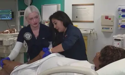
Innovative Surgery Restores Confidence for Breast Cancer Patients

Steve Kerr Supports Jonathan Kuminga After Ejection in Preseason Game

Kelsea Ballerini Launches ‘Burn the Baggage’ Candle with Ranger Station

Chicago’s Viral ‘Rat Hole’ Likely Created by Squirrel, Study Reveals
-
Science4 weeks ago
University of Hawaiʻi Joins $25.6M AI Project to Monitor Disasters
-
 Business1 month ago
Foreign Inflows into Japan Stocks Surge to ¥1.34 Trillion
-
 Top Stories1 month ago
BOYNEXTDOOR’s Jaehyun Faces Backlash Amid BTS-TWICE Controversy
-
 Top Stories1 month ago
Carson Wentz Out for Season After Shoulder Surgery: Urgent Update
-

 Top Stories1 month ago
Marc Buoniconti’s Legacy: 40 Years Later, Lives Transformed
-
 Health1 month ago
Innovative Surgery Restores Confidence for Breast Cancer Patients
-
 Sports2 months ago
Steve Kerr Supports Jonathan Kuminga After Ejection in Preseason Game
-
 Lifestyle2 months ago
Kelsea Ballerini Launches ‘Burn the Baggage’ Candle with Ranger Station
-
 Science2 months ago
Chicago’s Viral ‘Rat Hole’ Likely Created by Squirrel, Study Reveals
-

 Entertainment2 months ago
Zoe Saldana Advocates for James Cameron’s Avatar Documentary
-

 Lifestyle2 months ago
Dua Lipa Celebrates Passing GCSE Spanish During World Tour
-

 Health2 months ago
Community Unites for Seventh Annual Mental Health Awareness Walk