Lifestyle
International Team Launches ‘Google Maps’ for Ancient Roman Roads
A groundbreaking visualization tool called Itiner-e has been developed by an international team of researchers, offering a virtual map of the ancient Roman roads. This innovative resource enables users to explore the extensive network that once connected Europe, the Near East, and North Africa. The tool is described by Tom Brughmans, an archaeologist from Aarhus University in Denmark, as the “Google Maps for Roman roads.”
The interactive map is the culmination of over 200 years of research on Roman infrastructure. It spans more than 300,000 kilometers (approximately 186,000 miles) of the Roman Empire’s transportation system. Brughmans emphasized that the project aims to create a comprehensive resource that allows continuous contributions from scholars to enhance the database.
New Perspectives on Ancient Travel and Trade
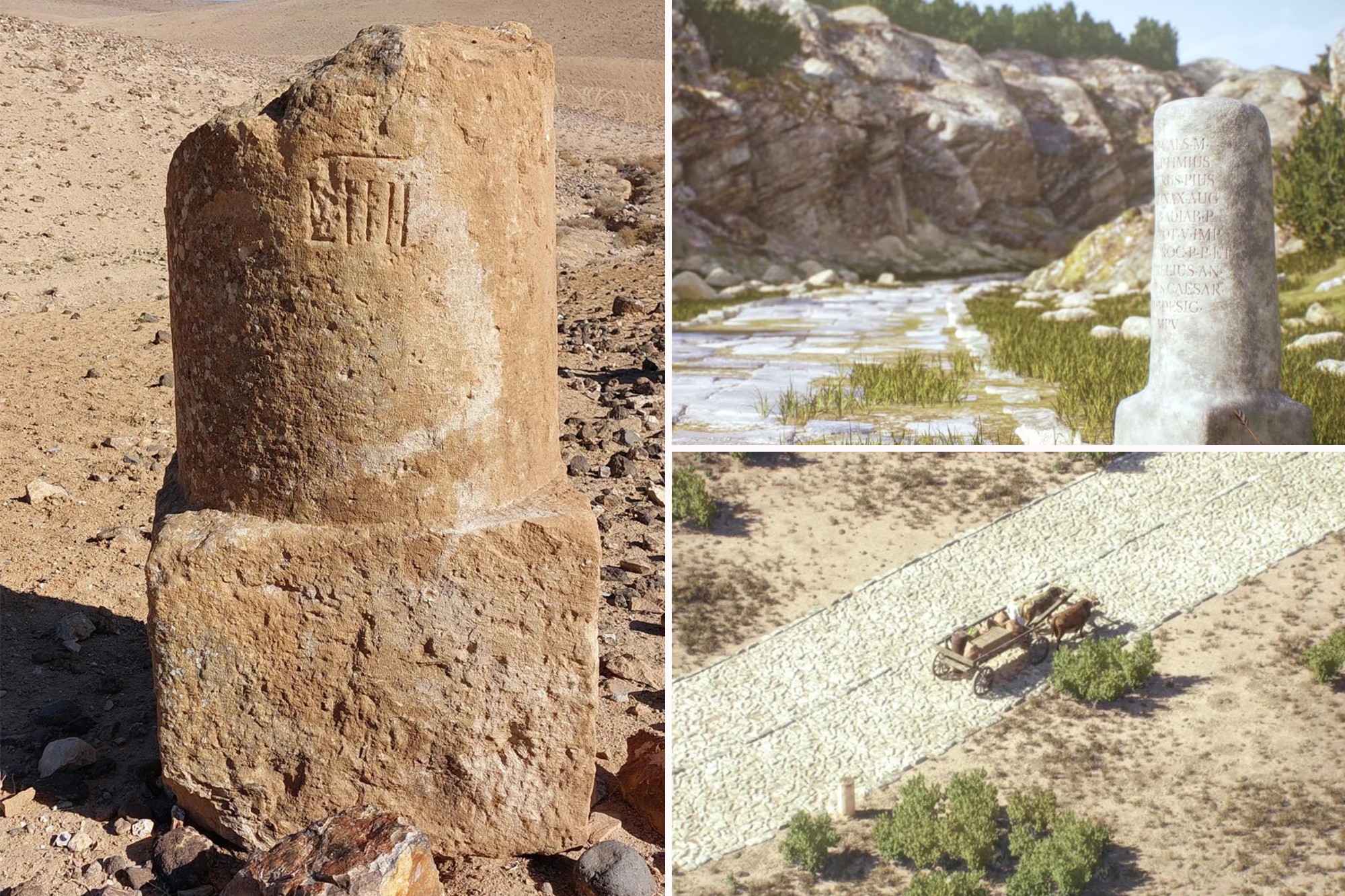
The creators of Itiner-e hope that the map will provide users with insights into how people, ideas, and even infectious diseases spread throughout the Roman Empire over 2,000 years ago. By interacting with this digital representation, users can visualize the routes taken by Romans as they transported food, wine, people, and military supplies in horse-drawn chariots and carriages.
This dataset amalgamates a wide range of research, presenting a more inclusive understanding of the Roman road network than previously available. Dr. Catherine Fletcher, a historian at Manchester Metropolitan University in the UK, noted, “This dataset brings together a huge range of research to give a bigger and more comprehensive picture of the Roman road network than we’ve had before.”
While the tool offers a remarkable glimpse into the past, it is essential to recognize its limitations. The map’s accuracy is variable; approximately 90% of the roads depicted are not exact, and about 7% are based on hypotheses. These discrepancies arise from the uneven availability of data and the challenges associated with identifying distinct types of Roman roads.
As this tool gains traction, it not only enriches our understanding of ancient infrastructure but also serves as a platform for ongoing scholarly engagement. Researchers and enthusiasts alike are encouraged to contribute to the database, ensuring that Itiner-e remains a vital resource for both education and exploration of the Roman Empire’s vast network.

NATO Declares ‘Turning the Tide’ on Russia’s Ammo Advantage

FAA Workers Warn Shutdown Threatens Air Travel Safety Nationwide

Kinzinger Slams Heritage Foundation President Over Fuentes Defense
China’s October Exports Plunge 0.8% as Imports Rise 1.4%

James Harden Misses Game for Clippers vs. Suns Due to Personal Reasons

Urgent: Dublin Home Sells for $1.7 Million in Swift Deal

Clockout CEO Denies $80K Salary Requirement, Clarifies App’s Focus

3D Printing Revolution: 5 Innovative Projects You Must Try NOW

Safeway to Close Hayward Store by 2026, Jobs to Be Saved
Marc Buoniconti’s Legacy: 40 Years Later, Lives Transformed

Steve Kerr Supports Jonathan Kuminga After Ejection in Preseason Game

Chicago’s Viral ‘Rat Hole’ Likely Created by Squirrel, Study Reveals

Dallin H. Oaks Assumes Leadership of Latter-day Saints Church
Zoe Saldana Advocates for James Cameron’s Avatar Documentary

Tyler Technologies Set to Reveal Q3 2025 Earnings on October 22

Kelsea Ballerini Launches ‘Burn the Baggage’ Candle with Ranger Station

13-Year-Old Hospitalized After Swallowing 100 Magnets

Dua Lipa Celebrates Passing GCSE Spanish During World Tour
-

 Top Stories2 weeks ago
Marc Buoniconti’s Legacy: 40 Years Later, Lives Transformed
-
 Sports3 weeks ago
Steve Kerr Supports Jonathan Kuminga After Ejection in Preseason Game
-
 Science3 weeks ago
Chicago’s Viral ‘Rat Hole’ Likely Created by Squirrel, Study Reveals
-
 Politics3 weeks ago
Dallin H. Oaks Assumes Leadership of Latter-day Saints Church
-

 Entertainment3 weeks ago
Zoe Saldana Advocates for James Cameron’s Avatar Documentary
-
 Business3 weeks ago
Tyler Technologies Set to Reveal Q3 2025 Earnings on October 22
-
 Lifestyle3 weeks ago
Kelsea Ballerini Launches ‘Burn the Baggage’ Candle with Ranger Station
-
 Health2 weeks ago
13-Year-Old Hospitalized After Swallowing 100 Magnets
-
 Lifestyle3 weeks ago
Dua Lipa Celebrates Passing GCSE Spanish During World Tour
-

 Health3 weeks ago
Community Unites for Seventh Annual Mental Health Awareness Walk
-

 World3 weeks ago
D’Angelo, Iconic R&B Singer, Dies at 51 After Cancer Battle
-

 Sports3 weeks ago
Patriots Dominate Picks as Raiders Fall in Season Opener